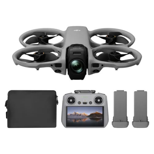
Dock 3 compatible drone system
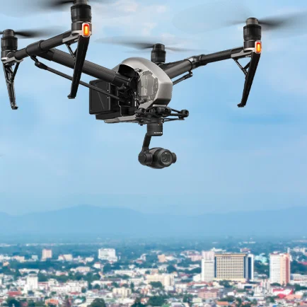
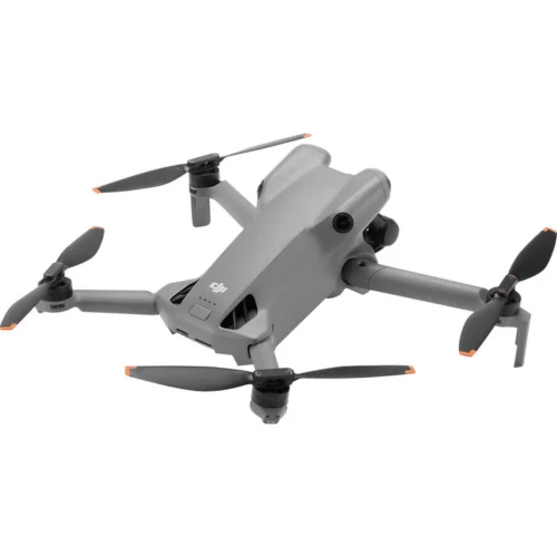
DJI Matrice 4TD Drone
The new waterproof and dustproof DJI Matrice 4D and 4TD are specifically designed for DJI Dock 3, offering extended flight range and connecting to the DJI RC Plus 2 Enterprise for standalone use. Both drones are equipped with a wide-angle camera, a medium telephoto lens, a telephoto lens, and a laser rangefinder. The Matrice 4D is highly effective for high-precision professional mapping and detailed surface inspection. The Matrice 4TD is equipped with an infrared thermal camera and a new NIR auxiliary light, making it ideal for a wide range of applications such as infrastructure inspections, emergency response, and public safety.

Longer flight time, robust protection
When fully charged, the Matrice 4D/4TD offers an impressive 47-minute flight time at a speed of 15 m/s, a remarkable 37% increase in runtime. [11] Within a 10 km radius, these drones offer 18 minutes of runtime. [12] Both models are built to withstand harsh conditions with an impressive IP55 water and dust resistance rating.

Obstacle detection for safe operation
The Obstacle Sensing Module [4] for Matrice 4D/4TD combines millimeter-wave radar and rotating LiDAR technologies to accurately avoid obstacles at 12 mm wire level at speeds of up to 15 m/s at complex power line crossings, as well as to optimize positioning in low-light conditions. [5] Operational safety is ensured for variable electrical distribution grid environments and complex substation layouts. [15]

Excels in low-light environments
Matrice 4D series drones feature four high-resolution fisheye lenses for low-light conditions, significantly improving [11] low-light visual positioning and obstacle detection. A new Night Scene mode offers full-color night vision. The Matrice 4TD also offers an IR-cut filter for black and white night vision and 24/7 operation, as well as a new NIR auxiliary light that can cover distances of up to 100 m. [10]
The Matrice 4TD infrared thermal camera supports UHR infrared imaging mode with image resolutions up to 1280 × 1024 and a high resolution mode for detailed temperature readings.

Clear vision and stable images
Matrice 4D series drones are equipped with medium-telephoto and close-up stabilized telephoto cameras. The medium-telephoto camera is effective for medium-range inspections, detecting bolts and cracks at 10 meters and clearly reading instrument data in substations. [16]
The 48MP telescopic camera captures details, such as signs, from up to 250m away.[17] When using the Matrice 4TD’s telescopic camera while the aircraft is hovering in a windless environment, the gimbal can be tilted upwards by 80 degrees, making defects on the underside of the bridge clearly visible.
Enhanced stabilization keeps foreground subjects clear during telephoto shots at 10x zoom or higher.

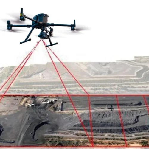
High-precision topography
Matrice 4D series drones excel in high-precision mapping, offering a new 5-way oblique photography function, 3-way orthophoto photography,[5][18] and real-time terrain following to meet various mapping requirements.
DJI FlightHub 2 has been updated for Matrice 4D/4TD operations. This update adds a variety of flight path planning options, including Intelligent 3D Capture Routes [5], Geometric Routes, and Slope Routes, improving efficiency and ensuring detailed modeling.

Seamless aerial relief for mountainous terrain
The Matrice 4D series can be operated with the DJI RC Plus 2 Enterprise remote controller for autonomous use, and features an innovative built-in relay function. With this setup, one drone can fly at high altitudes as a relay, allowing another drone to operate at greater distances. The relay drone automatically orients itself towards the operating drone [5], ensuring smooth video transmission without a 4G signal or in obstructed conditions [19]. This capability significantly extends the transmission range, making it ideal for search and rescue (SAR) tasks and inspections in mountainous areas.
Applications
Public Safety Agencies
Drones elevate public safety agencies by improving response times, reducing operating costs, and improving decision-making while ensuring the safety of personnel in critical operations.
Inspection of power lines.
Manage power grids and plants with drones. Monitor construction, perform inspections, and perform maintenance with ease.
Geographic Information
Perform topographic surveys and generate a variety of data outputs with greater efficiency and reduced operating costs.
Oil and Natural Gas
Revolutionizing the oil and gas industry by improving efficiency in management, inspection, and construction, while reducing costs and driving technological innovation.
Renewable Energy
Flexible and mobile, capable of automatically inspecting flight paths, effectively ensuring personnel safety and increasing revenue from power generation.
Roads and Bridges
Drones equipped with high-resolution cameras can meticulously inspect critical bridge components, including decks, piers, and cables.


Reviews
There are no reviews yet.