

Made in the USA: ANAFI USA offers the same high-end security, durability, and image capture capabilities as Parrot’s Short Range Reconnaissance (SRR) drone designed for the U.S. military. ANAFI USA’s data encryption and privacy features are compliant with the European Union’s General Data Protection Regulation (GDPR), providing best-in-class privacy and security for sensitive missions.
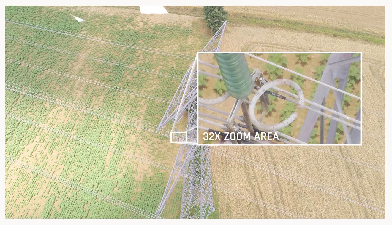
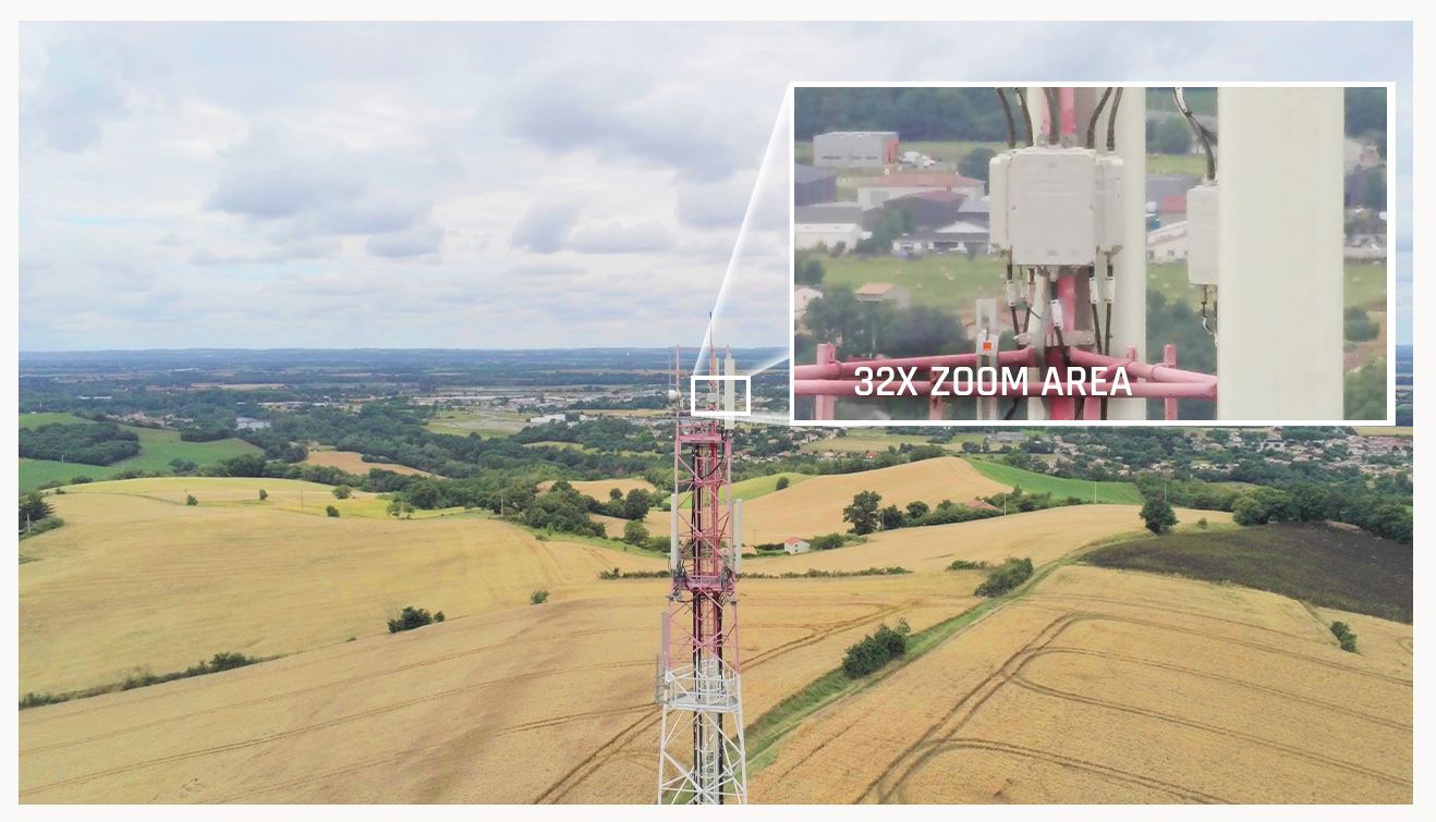
When firefighters arrive at a fire scene, the most important need is to see hot spots while also being able to assess the entire visual scene. ANAFI USA’s gimbal and advanced optics were designed with this challenge in mind. The 32x zoom is built around two 21-megapixel cameras, allowing operators to clearly see details from up to 5 km (3.1 mi) away.
The zoomed image is combined with images from ANAFI USA’s FLIR camera. This allows operators to detect critical points with the thermal camera, while the visual camera allows them to see people and other important details up to 2 km (1.2 mi) away.
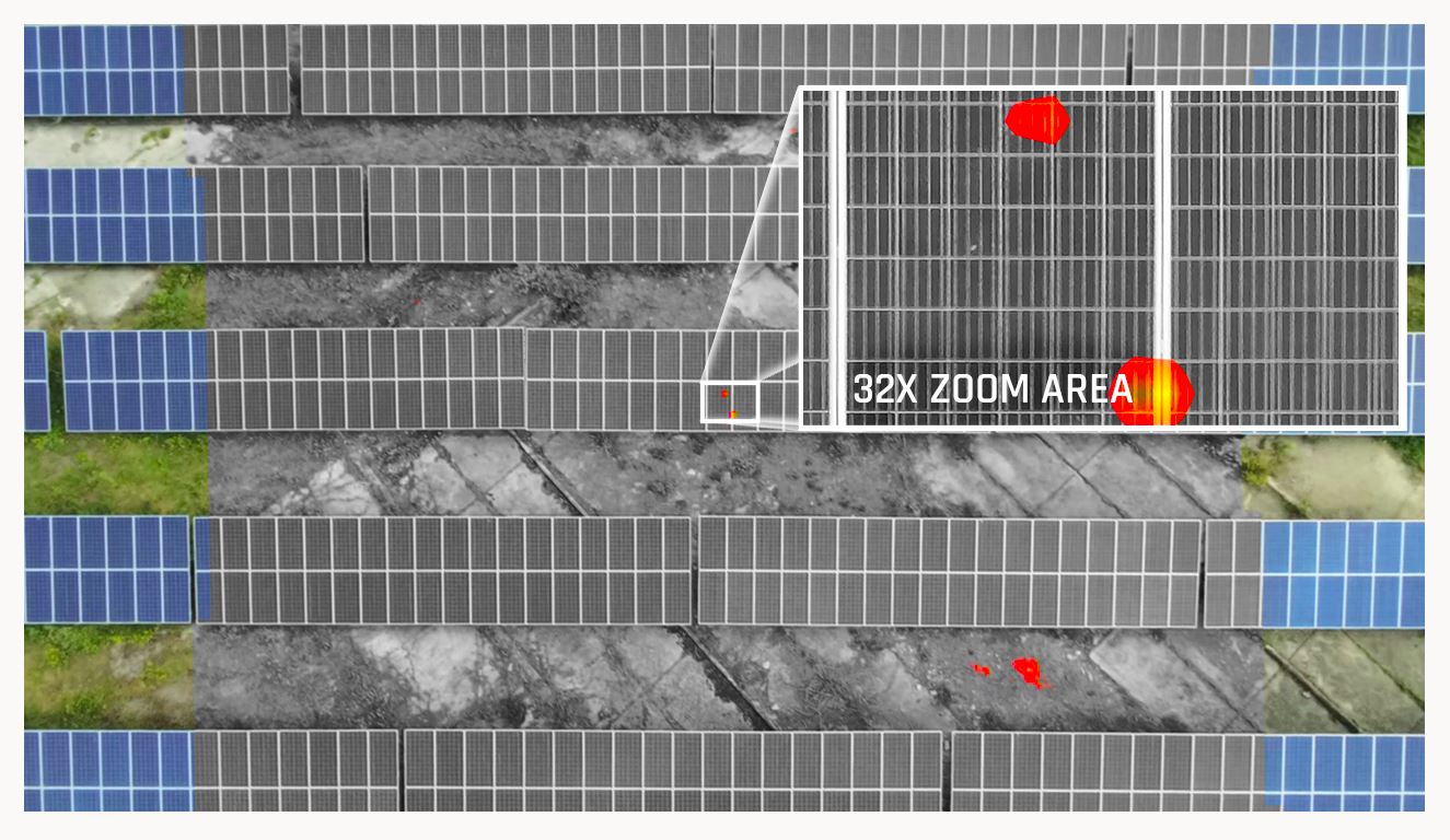
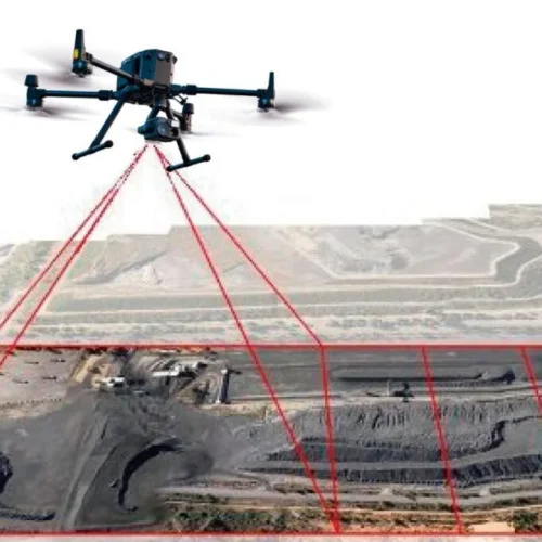
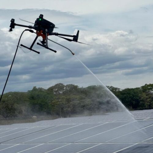
In the example image below, the drone is flying over solar panels at an altitude of 40 m (44 yds). With ANAFI USA’s powerful zoom, the pilot can detect centimeter-sized hot spots on the solar panels.
Ensuring excellent image stabilization in 32x zoom images with a lightweight drone (500 g/1.1 lbs) is a particularly delicate technological achievement. Parrot achieved this feat by combining gimbal stabilization with full 3-axis digital stabilization using image processing.
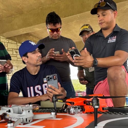
For first responders and the most demanding professional users, rapid drone deployment is a must during missions. ANAFI USA is operational in less than 55 seconds: it takes less than 55 seconds to deploy the drone, power it up, establish a secure radio link, and take off.
ANAFI USA works indoors without GPS, allowing operators to take off inside a home, fly the drone through a window to fly outside, and then return.
ANAFI USA can also be launched from the palm of your hand like a paper airplane, further expanding its ease of use.
With no built-in no-fly zone restrictions, ANAFI USA gives first responders the freedom to fly responsibly anytime, anywhere their missions take them.
ANAFI USA is the quietest drone in its class, with a sound level of only 79 dB when 50 cm above the ground.
Uses a standard USB-C charger for hassle-free convenience.
Weighing just 500g (1.1 lb), the compact ANAFI USA folds easily for maximum portability. Despite its compact design, ANAFI USA boasts a 32-minute flight time, also best-in-class for a drone of its size.
Photos and videos are encrypted on the SD card using an AES-XTS algorithm with a 512-bit key length. ANAFI USA’s Secure Digital (SD) card encryption feature ensures that saved data cannot be read if the drone or SD card is lost or stolen. Once encrypted, the data can only be read with the decryption key.
ANAFI USA also includes a secure WPA2 Wi-Fi connection. WPA2 provides authentication and encryption of the link between the remote control and ANAFI USA.
Signed firmware prevents any malicious modification of the drone’s software.
Parrot uses reliable standards and open protocols (such as Wi-Fi, WPA2, RTP/RTSP, H.264 and GUTMA) to ensure maximum interoperability and security for all recorded data.
Users can opt in to data sharing through the FreeFlight 6 app. By default, no data is shared without the user’s consent. Once this feature is opted in, data and flight logs are stored on secure servers in Europe, in addition to local copies of the data on the drone. The drone’s features are fully compliant with the European Union’s General Data Protection Regulation (GDPR).
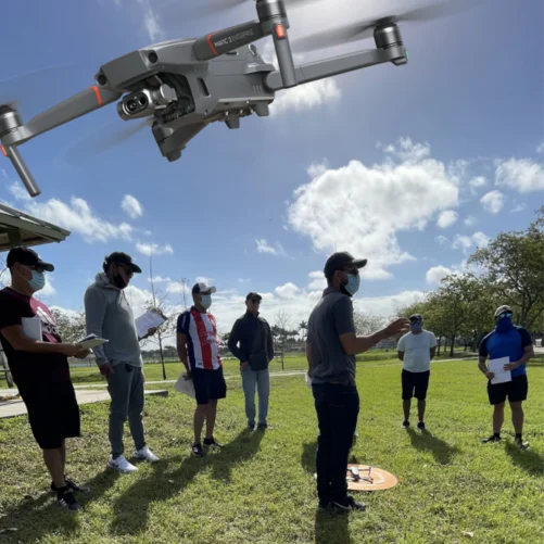
ANAFI USA’s advanced flight features are designed to meet the unique needs of business drone users. Thanks to Parrot’s acclaimed FreeFlight 6 piloting software, pilots have multiple, easy-to-use flight options. ANAFI USA’s flight paths can be set by coordinates in assisted framing or executed autonomously.
The ability to create a flight plan with preset automatic flights and target tracking makes it easier for the entire team to carry out missions.
With an editable Return to Home (RTH) feature, the drone allows users to program a specific return-to-home location to easily complete the mission. This RTH feature is automatically activated when the drone is disconnected or running low on battery power, helping to protect your organization’s investment.
ANAFI USA captures the precise GPS coordinates of the drone and the point of interest, providing detailed location information to help field operations leaders quickly locate targets such as missing persons or hazardous materials.
Compatible with industry-leading mapping software Pix4Dreact, ANAFI USA enables first responders to quickly transform images into accurate 2D maps on a handheld computer.
Through its open-source SDK and use of industry-standard protocols, ANAFI USA supports a growing ecosystem of professional applications and services, such as Survae (an intelligent search and visualization platform that connects video, imagery, and sensor data with interactive maps and timelines), DroneLogbook (compliance and fleet management), Kittyhawk (compliance and safety for enterprise UAS fleet management and airspace), DroneSense (a comprehensive drone management platform that enables public safety organizations to build, manage, and scale their unmanned aircraft programs), Planck AeroSystems (autonomous landing on a moving vehicle), and Skyward, a Verizon company (an aviation management platform, including airspace, LAANC access, as well as training, hardware, and connectivity for enterprise drone fleet deployments).
Other partners are working hard to join the ecosystem in the coming months, making ANAFI USA a benchmark platform for professional use.
Designed for the U.S. Army, the drone is manufactured in Massachusetts, USA.
Reviews
There are no reviews yet.